News
"Hong Kong Guide" and "e-HongKongGuide" 2017 edition available for Public

The "Hong Kong Guide" 2017 edition produced by the Lands Department (LandsD) is on sale starting today (January 6). And the "e-HongKongGuide", a newly launched electronic map book, has also been uploaded onto LandsD's website for free download.
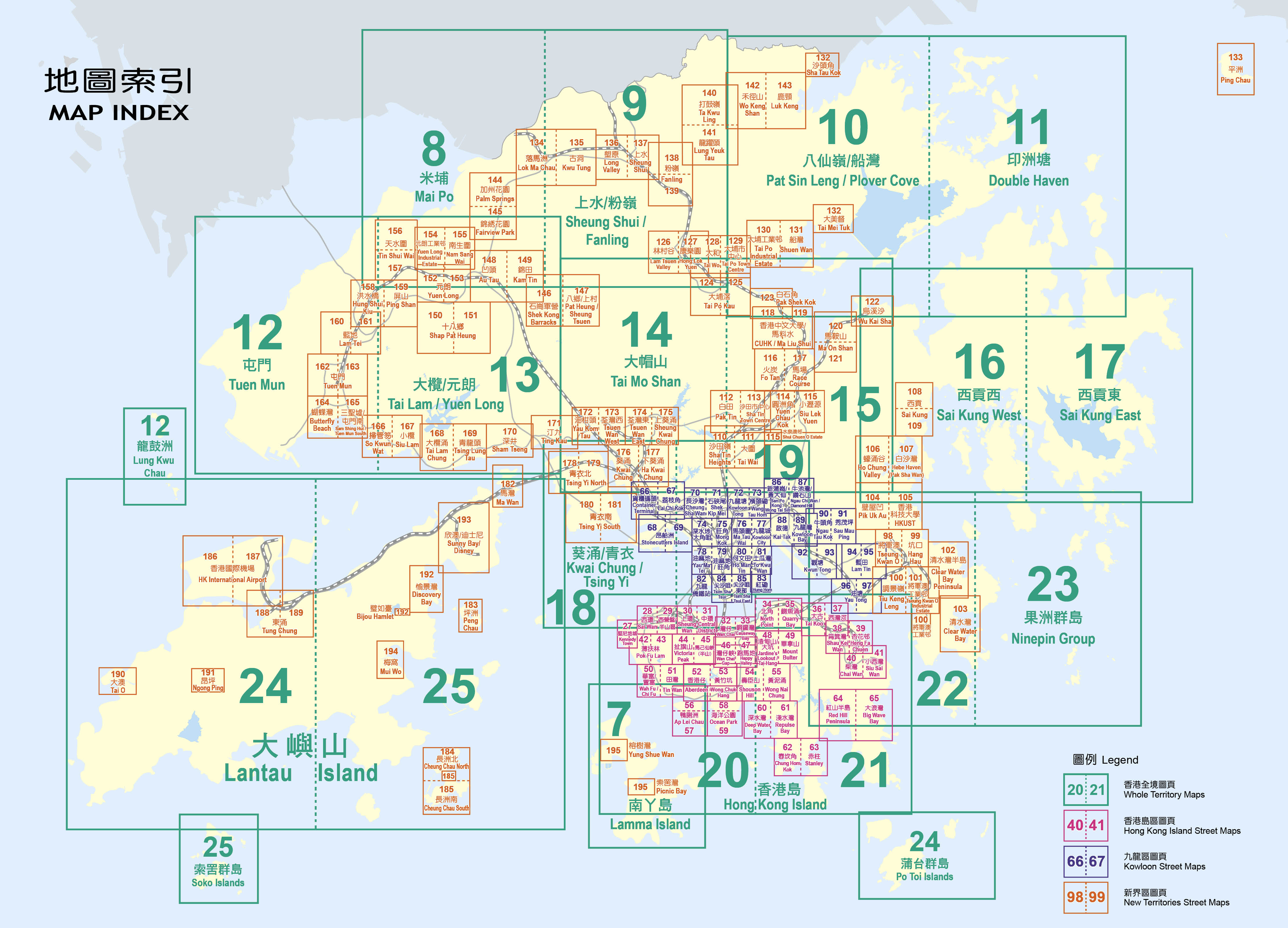
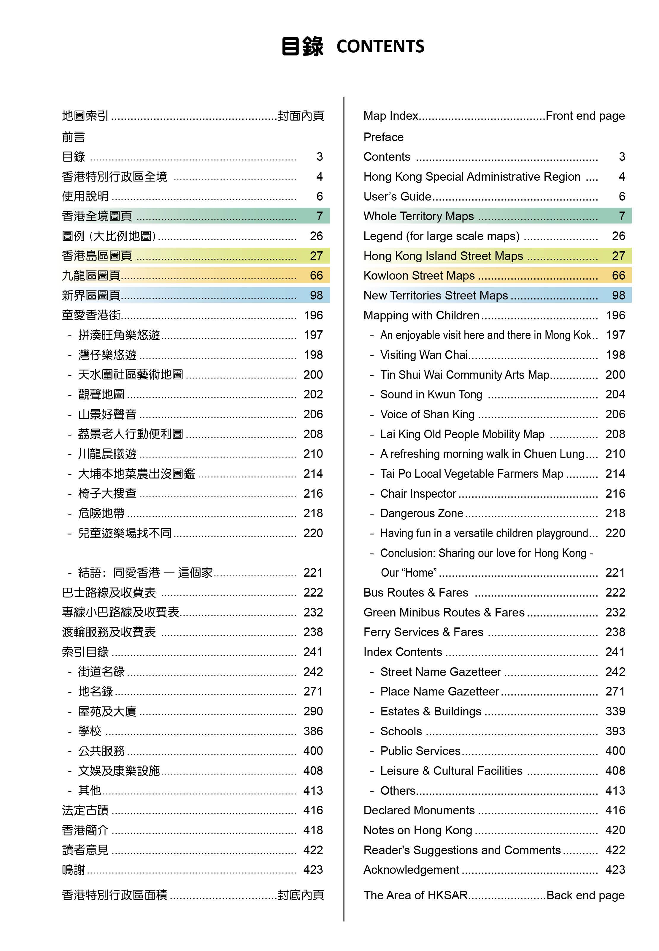
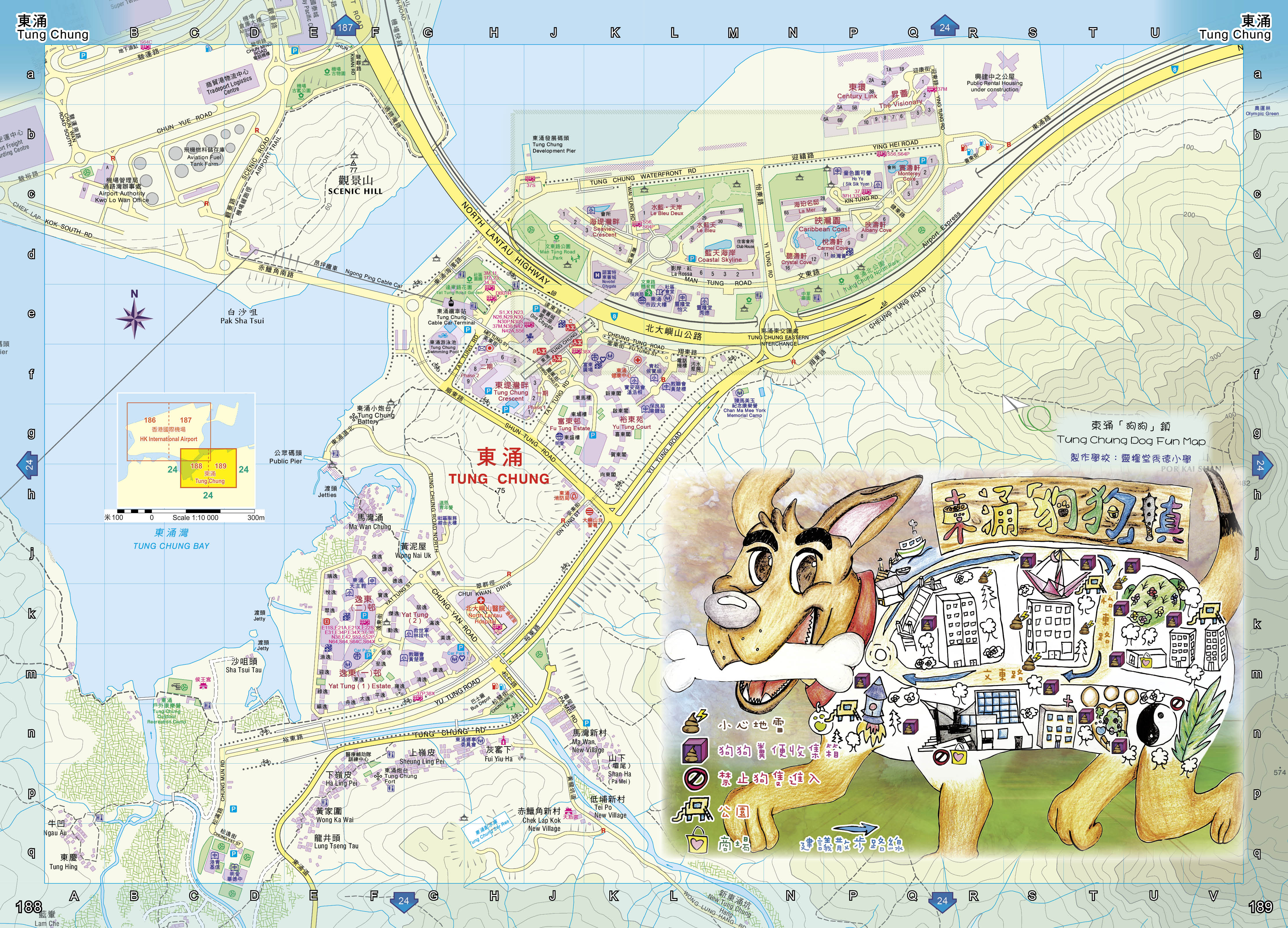
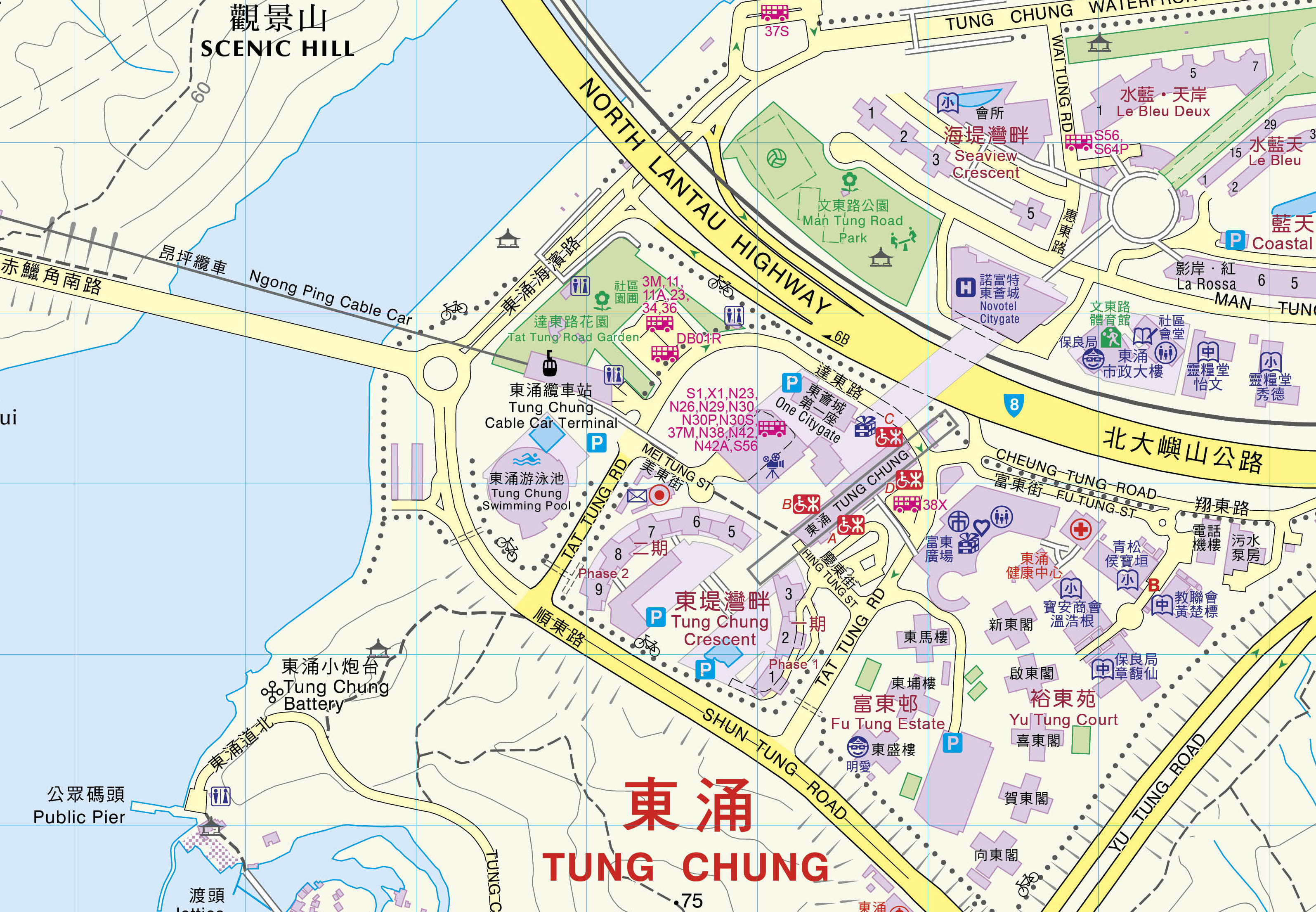
The 424-page new "Hong Kong Guide" provides detailed maps covering the whole territory of Hong Kong. It also contains indexes of streets, places and villages, estates and buildings, schools, public services, and leisure and cultural facilities, as well as information on public transportation.
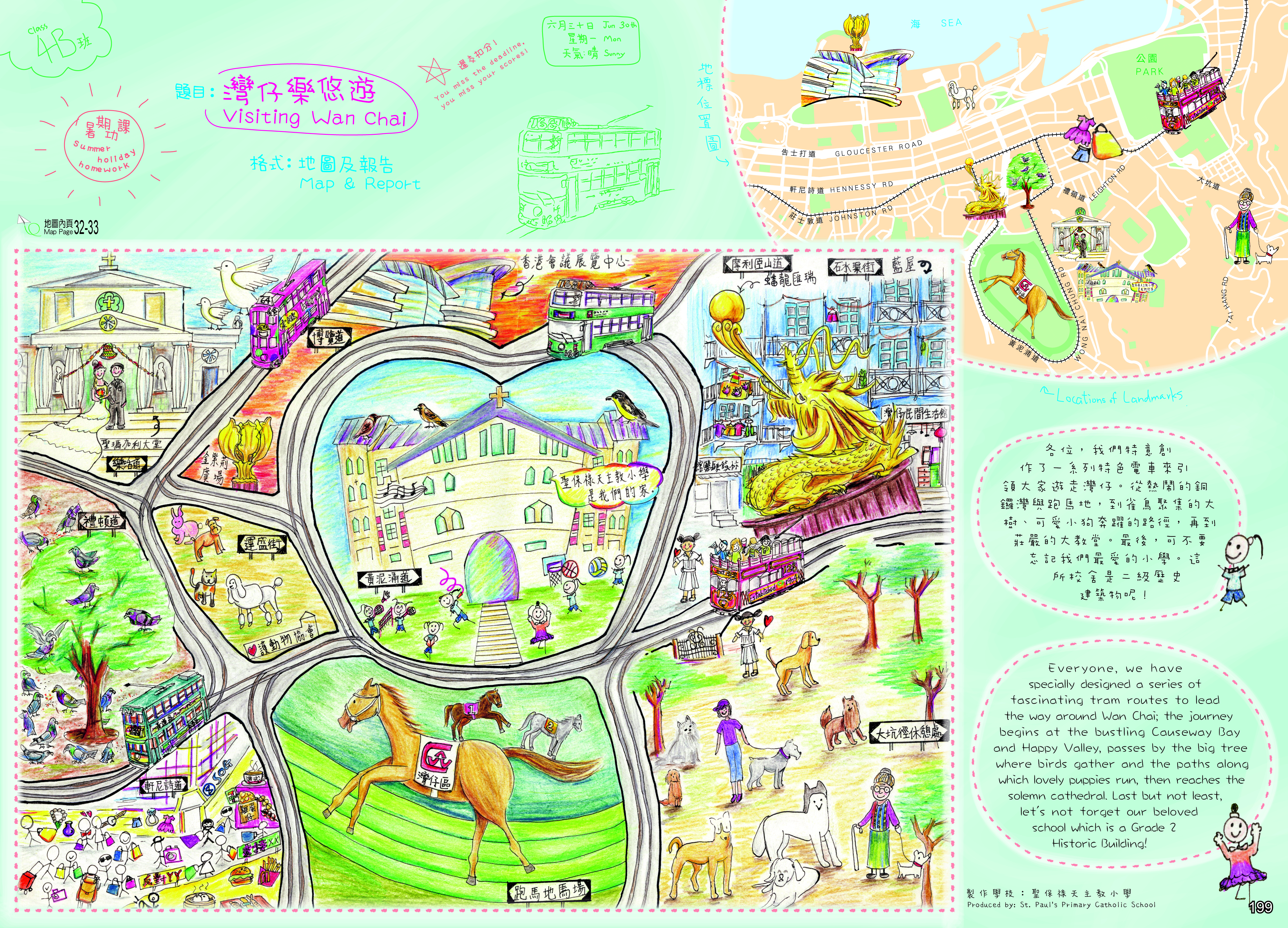
It is the first time this year's Hong Kong Guide has been spiced up with a number of community art maps provided by the Hong Kong Arts Development Council (HKADC) and created by local school children and teachers with different themes. These art maps, with interesting topics and heart-warming messages, were drawn with purity and sincerity and are worth appreciation.
The community art maps have touched up the function-oriented Hong Kong Guide and given it a theme of "Mapping with Children", with an intention to guide the public to explore the community through "a Book of Affection, a Map of Love."
The "Hong Kong Guide" 2017 edition, priced at $75, is available at all sales outlets of the LandsD's Survey and Mapping Office (SMO), six post offices (General Post Office, Kowloon Central, Tsim Sha Tsui, Mong Kok, Kwun Tong and Tuen Mun Central), certain local bookstores and the SMO's online map shop. Information on the SMO's sales outlets can be found at "Map Sales Outlets". For enquiries, please call 2231 3187.
The "e-HongKongGuide" 2017 edition, the first electronic map book produced by the LandsD, is now available for free download at LandsD's website.
The design and content of "e-HongKongGuide" is based on the "Hong Kong Guide". Users can also access the theme pages of "Hong Kong Guide" 2017 edition - "Mapping with Children" through "e-HongKongGuide".
"e-HongKongGuide" is a collection of maps in the formats of GeoPDF®. Apart from PDF readers, these maps can be read by different applications on desktop computers and mobile devices in an offline mode. By using free tools available on the web, users can read coordinates, track positions using a GPS device, search coordinates, search text and information, add personalised images and information, and share with friends.
- Hong Kong Guide 2017 - Map Index
- Hong Kong Guide 2017 - Contents
- Sample Map | Portion Enlargement
- Sample Theme Page

