Digital Aerial Photo (DAP)
The Digital Aerial Photo (Series: DAP), which is one of the digital map products, is the digital format of an aerial photograph produced from its original aerial film (taken by Lands Department from Year 1963 to mid-2016) by means of scanning at a resolution of 1,800dpi or better with a high-precision photogrammetric scanner. The DAP is suitable for photogrammetric measurement. In purchasing the DAP, the relevant camera calibration report, if available, would be provided.
The DAP is provided in TIFF Format and the delivering media is DVD. The file size of Black & White and Colour aerial photograph images is about 300MB and 1.1GB respectively. Customers can order the DAP at the Hong Kong Map Service 2.0 website.
Black and White - Vertical (Full Frame)
")
Black and White - Vertical (Portion)
")
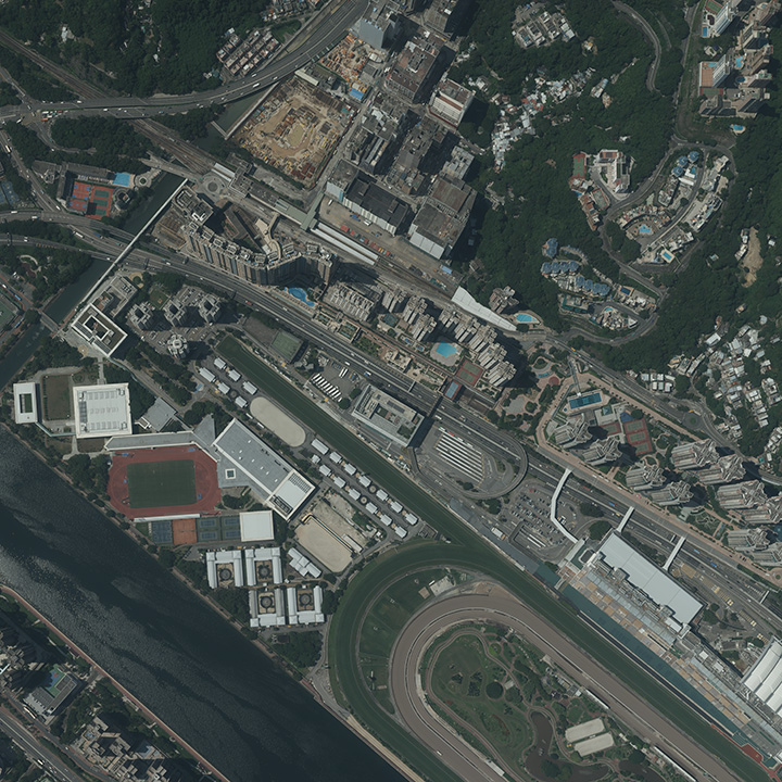
Colour - Vertical (Full Frame)
")
Colour - Vertical (Portion)
")
Digital Aerial Photo (UE Version) (DAP-UE)
The Digital Aerial Photo (UE Version) is the digital aerial photograph captured by the large format digital aerial camera which was put in commission in mid-2016. The digital aerial camera is able to capture five spectral bands information (Panchromatic, Red, Green, Blue and Near-infrared). The dynamic range of the colour information is higher than 12-bit. A total of three products, DAP_RGBI, DAP_RGB and DAP_CIR, are generated for each shot. Photo information, for example photo number, date of flight, flying height etc., is kept in the EXIF data instead of presenting on the image
DAP_RGBI is digital aerial photograph in 16-bit file format consisting of four spectral bands (Red, Green, Blue and Near-infrared) with a file size about 2GB. No radiometric correction or colour balancing is applied in order to retain the original colour to facilitate spectrum study.
DAP_RGB and DAP_CIR are digital aerial photographs in 8-bit file format with radiometric correction applied with a file size about 760MB. DAP_RGB is RGB colour image (consisting of Red, Green and Blue bands) while DAP_CIR is false colour infrared image (consisting of Near-infrared, Red and Green bands).
The DAP-UE is suitable for photogrammetric measurement. In purchasing the DAP-UE, the relevant camera calibration report would be provided.
The DAP-UE is provided in TIFF Format with World File, the georeference information stored in World File is only for general position only. The delivering media is DVD. Customers can order the DAP-UE at the Hong Kong Map Service 2.0 website.
DAP_RGBI - (Full Frame)
")
DAP_RGB - (Full Frame)
")
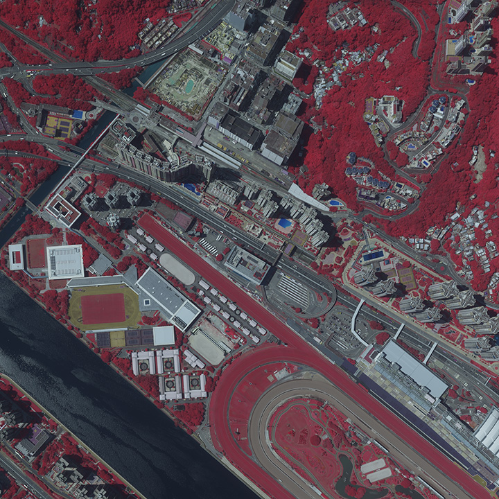
DAP_CIR - (Full Frame)
")
Digital Aerial Photo (L0 Version) (DAP-L0)
The Digital Aerial Photo (L0 Version) is a compressed image of the afore-mentioned Digital Aerial Photo (DAP). Digital Aerial Photo (UE Version) (DAP-UE) or the scanned image of a print of an aerial photograph, whichever is available, which is saved in 300 dpi image resolution and JPEG format with a file size about 2-3 MB.
The DAP-L0 can be used to support a wide range of applications, e.g. different types of web-services showing bird's-eye view, desktop photo printing and illustration in reports and presentations, etc., with superb quality at a lower cost than the price of a DAP.
Customers can download the DAP-L0 at the Hong Kong Map Service 2.0 website.
DAP-L0
Black and White - Vertical (Full Frame)
")
Colour - Vertical (Full Frame)
")
False Colour Infrared - Vertical (Full Frame)
")
DAP-L0-RGB
Colour - Vertical (Full Frame)
")
Colour - Oblique (Full Frame)
")
DAP-L0_CIR
False Colour Infrared - Vertical (Full Frame)
")
False Colour Infrared - Oblique (Full Frame)
")
The Hong Kong Digital Map is supplied to the customers at a charge which is calculated according to the current Price List published by the Government.
Download Price List 
