“e-Hong Kong Guide” 2026 July Edition

The "e-HongKongGuide" 2026 July edition is now available on the LandsD's website for public viewing and free download. In the July edition, all detailed maps of Hong Kong, as well as gazetteers of street and place names, have been updated to June 2026.
The maps, provided in GeoPDF format, can be used offline on both desktop computers and mobile devices. A total of 119 maps are available for printing in A3/A4 sizes. Users can easily locate their positions on the "e-HongKongGuide" maps with satellite positioning functions. In addition, link buttons to relevant maps are extended to mobile device application for easy browsing.
1:10 000 Street Plan

Sheet size : 685 x 980 mm
This is a street map series consisting of 59 regular sheets to cover the whole territory. It contains rich information of buildings, roads, and public facilities, with contours represented at 20m interval.
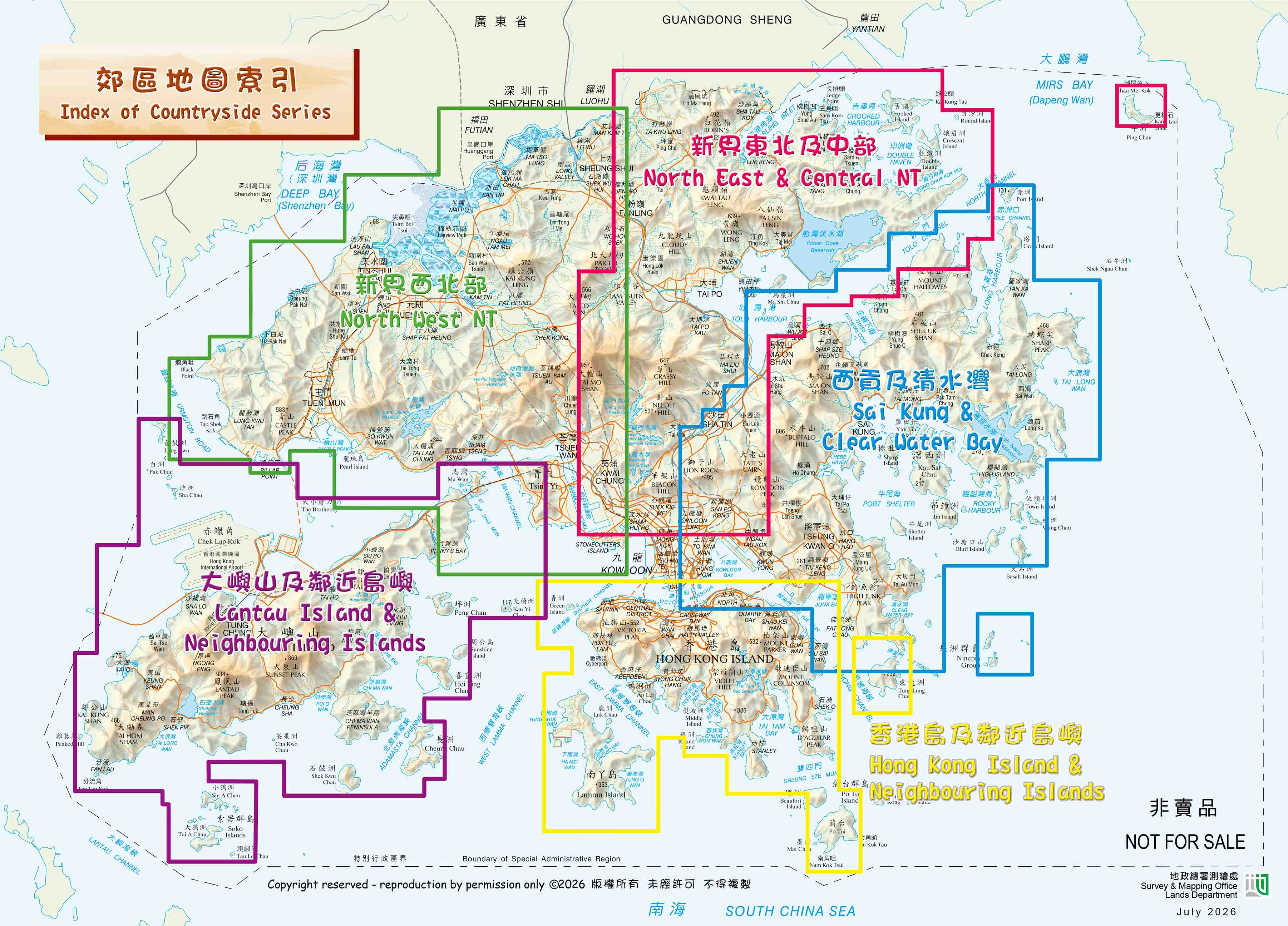
Map IndexMap Legend


")


 Edition 1/2026 (1:400 000)")


